

A' Chraileag [A' Chralaig]
Good walks are even better shared.
NH0914 : On the summit ridge of A' Chràlaig
Russel Wills Photo source
Overview
A' Chraileag [A' Chralaig]
Situated in the heart of the Scottish Highlands, A' Chraileag stands proudly at 1129 meters, offering both challenge and beauty to all who dare to ascend.
Geology
The geological composition of A' Chraileag features rugged granite and schist, forming a sturdy backbone to this majestic giant. This rocky foundation not only gives rise to stunning vistas but also embodies the raw, unyielding character of the Highlands.
Routes
The most popular route is the Allt a' Chraileag, which is manageable for various skill levels. Spanning roughly 8.5 kilometers, it takes an average of four hours to complete. Hikers are treated to scenic views of glens and valleys, ensuring a rewarding trek. It’s a great day out to blow away the cobwebs, and perhaps even spot some local wildlife along the way!
Terrain Type
Expect a mix of rocky paths and grassy inclines. Caution is advised in boggy areas, particularly during rainy spells. So, sturdy footwear is a must – you wouldn’t want to lose a shoe to a Highland bog!
Views
As you reach the summit, the sight of Loch Duich on one side and the impressive Five Sisters of Kintail on the other will leave you breathless – and not just from the hike! The best time for viewing these spectacular scenes is in spring or autumn, when the air is crisp and the visibility is at its best. Remember, a little bit of sunshine goes a long way in the Scottish Highlands!
Hazards
While the journey is overwhelmingly rewarding, do keep an eye on the weather. Conditions can change quicker than you can say, 'Scottish drizzle!' Hikers should be wary of slippery paths and sudden fog which can roll in faster than a sheep in a hurry.
Nearby Summits
A' Chraileag is not lonely in its majesty. Nearby summits such as Sgurr na Gillean and Sgurr an Lochain beckon adventurous souls for more exploration. Each offers unique panoramas and hiking experiences to savour.
Access
For those driving, the Allt a' Chraileag car park is your best bet. If you're relying on public transport, note that services from Kyle of Lochalsh might test your patience, so check schedules in advance. Close by is the small town of Kyle of Lochalsh where you can stop for a cuppa or a hearty meal after your ascent.
Facilities
Facilities are minimal on the mountain but Kyle of Lochalsh brings the rescue team with shops and cafes to refresh those weary legs and validate your triumph on the peak.
History
The name A' Chraileag translates to 'the rocky hill' – a fitting tribute to this sturdy giant. The mountain has woven itself into local folklore, with tales as rugged as its terrain.
So gather your gear and set your sights on A' Chraileag! Whether you’re a seasoned hiker or simply looking for a beautiful day outdoors, this mountain promises an unforgettable experience.
Last Updated
2023-10-01
Source
Ordnance Survey
Explore routes near A' Chraileag [A' Chralaig]
Walks starting near this hill. Open a route to check its map, distance and full itinerary.
Glen Affric: Coire Loch Woodland Trail
View route
Fort Augustus to Kytra Lock: Caledonian Canal Towpath
View route
Banavie to Glen Loy Aqueduct: Neptune’s Staircase Canal Towpath
View route
Ben Nevis via Mountain Path
View route
Route planning notes
These notes describe possible approaches. Check a route's map and access information when planning your walk.
Allt a' Chraileag Route
This popular route begins at the Allt a' Chraileag car park, ascending through picturesque glens with plenty of scenic views. Perfect for both beginners and seasoned hikers.
Make a day of it, together
Find someone to share the walk with, or organise a day out along a route you like.
Photo Gallery
View all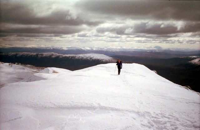 Photo could not load
NH0914 : On the summit ridge of A' Chràlaig
Russel Wills
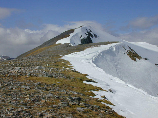 Photo could not load
NH0914 : Summit of A' Chralaig
Nigel Brown
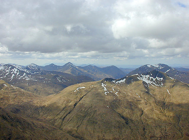 Photo could not load
NH0914 : Westward view from A' Chràlaig
Nigel Brown
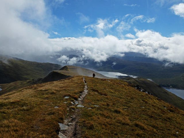 Photo could not load
NH0914 : South ridge of A' Chràlaig
John Allan
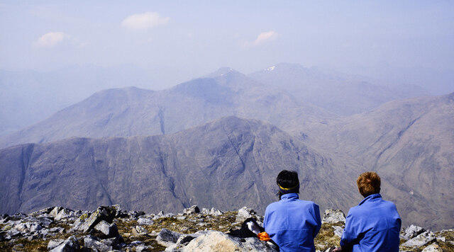 Photo could not load
NH0914 : Rocks and onlookers at summit of A' Chràlaig
Trevor Littlewood
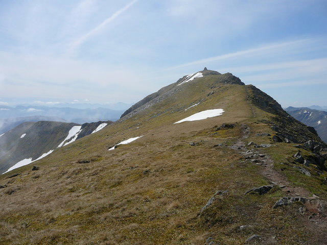 Photo could not load
NH0914 : The ridge north from A' Chralaig
Colin Park
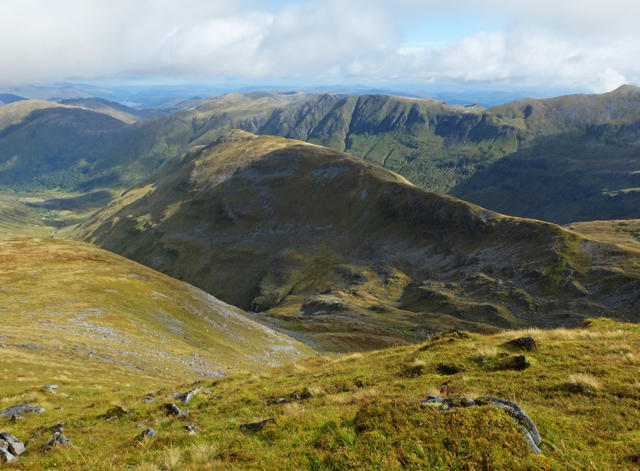 Photo could not load
NH0914 : View from A' Chràlaig
John Allan
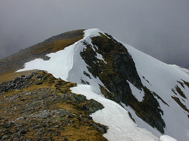 Photo could not load
NH0914 : The summit of A' Chralaig
Nigel Brown
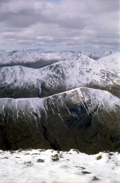 Photo could not load
NH0914 : View west from summit of A' Chràlaig
Russel Wills
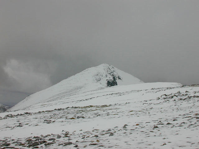
NH0914 : Along the south east ridge of A' Chràlaig
Nigel Brown
Hill facts and local notes
Classifications
Elevation
1,120m
3,675 ft
Prominence
786m
Coordinates
57.1842, -5.1548
NH094147
OS Map
33
Explorer: 414N 414S
At the Summit
The summit is marked by a large stone cairn, which makes for a great photo opportunity. From this point, you can soak in the expansive vistas.
Terrain & Geology
The mountain is predominantly composed of granite and schist, which provides stunning ruggedness and contributes to the dramatic landscape characteristic of the Highlands.
Views & Scenery
Notable landmarks visible from the summit include Loch Duich and the impressive Five Sisters of Kintail.
History & Heritage
Name Origin
A' Chraileag means 'the rocky hill' in Scots Gaelic, aptly describing its rugged features.
Historical Significance
The mountain is part of the scenic landscape that forms the Great Glen and is intertwined with local folklore and culture.
Getting There & Facilities
Parking
There is a designated car park at Allt a' Chraileag (NH087154), which accommodates several vehicles. Arrive early to secure a spot!
Public Transport
The nearest bus service runs from Kyle of Lochalsh which is about 8 miles away, but check the local schedules as they can be infrequent.
Nearby Facilities
There are no facilities directly on the mountain, but Kyle of Lochalsh has cafes, shops, and toilet facilities.
Safety Information
Known Hazards
- Be cautious of sudden weather changes as conditions can shift rapidly. Some areas may be prone to soggy ground, especially after heavy rainfall.
General Safety Tips
- Check weather conditions before setting out
- Carry appropriate clothing and equipment
- Let someone know your planned route
- Take a map, compass, and GPS device
- Carry emergency supplies: food, water, first aid kit, torch
Hills
Some common questions about the hills answered
Are there group walks up A' Chraileag [A' Chralaig]?
Many walkers use Walkmates to join or organise walks with others. You can check for group walks around A' Chraileag [A' Chralaig] through the maps
Are there other walkers around A' Chraileag [A' Chralaig]?
Activity varies by location and time, but Walkmates lets you see whether others have shared walks or shown interest in this area. Find other people through the walking friends search walking friends for A' Chraileag [A' Chralaig] search or of course create your own walk for A' Chraileag [A' Chralaig]
Can I organise a walk to A' Chraileag [A' Chralaig]?
Yes. If there aren’t any walks listed already, you can create a walk and make it available for others to join.
If you're signed up to Walkmates, you can create a walk to A' Chraileag [A' Chralaig].
How do I find a walk up this hill?
There are often multiple ways to walk this hill, depending on experience and route preference. Walkmates helps you explore walks and routes that others have shared.
Can I suggest a new route up A' Chraileag [A' Chralaig]?
Yes. You can suggest or create routes to share with others. Walkmates focuses on the social side of walking, so routes are used to help people organise walks and explore areas together, rather than as detailed navigation tools or route libraries.
Other uses really appreciate knowledgeable walkers sharing their routes. Share your favourite route to A' Chraileag [A' Chralaig] here
The is an error or something incorrect about this hill. How do I let you know?
We always strive to keep the information on Walkmates as accurate as possible. If you find an error, please let us know through the contact form and we'll aim to correct it as quickly as possible
Community Discussion
Comments
Location
![A' Chraileag [A' Chralaig] location map](https://cdn.walkmates.com/hill-maps/hill-sources/862/57.18419_-5.15484.png)
Grid reference: NH094147
View on OpenStreetMapOpens a map in a new tab, centred on the hill.
Nearby Hills
Mam Sodhail
1,179m
Carn Eighe
1,183m
Gleouraich
1,035m
Sgurr a' Mhaoraich
1,027m
Sgurr Fhuaran
1,069m
No comments yet. Be the first.